Sunday, February 25, 2007

Caicos

We are tucked into the South Caicos inside the Caicos Bank because of weather, we may be here a few days we have to see what the weather report says, but the seas are big and the winds are high so we are staying put. We will head to the west end of the Caicos when the weather clears and overnight there, then head over to Mayaguana the next day. Mayaguana is the beginning of the Bahamas. We are looking forward to Mayaguana because we check in there and it's good throughout the Bahamas :) YAHOO...but unfortunately it does cost $300...this includes the fishing license. The fishing license costs $150, I hope we catch alot of fish because we could buy a whole lot at that price and Mike wouldn't have to clean them.

This may sound weird, but it is cold here. We are wearing our sweatshirt's..brrrrrrrrr....it must be 75 degrees.

Our wind generator pooped and Mike says he has to climb the mast to look at it in 20-25 knot winds - that probably means Kim goes up the mast......

Our position is N 21.28.858 W 071.35.503

Shivering in the Bahamas, Mike and Kim

----------
radio email processed by SailMail
for information see:

http://www.sailmail.com

Saturday, February 24, 2007

Big Sand Cay, Turks

We arrived at Big Sand Cay in the Turks today at 3:15 PM. It's a really pretty little island, very small and very deserted. We are the only ones here. We're going to overnight here and leave in the morning for the Caicos, then head over to Mayaguana which is the Bahamas and we'll check in. We had an okay trip a little bumpy at times and we lacked wind. We traveled 308 nautical miles with an average speed of 5.5 knots and a maximum speed of 14.8 knots. It took us 56.5 hours. We haven't seen any Humpback whales yet. Our lat/long is N 21.11.256, W071.15.117.

Bye for now, Mike and Kim

----------
radio email processed by SailMail
for information see:

http://www.sailmail.com

Friday, February 23, 2007

At Sea Again

We are currently just of the coast of the Dominican Republic bound for the Turks and Caicos then the Bahamas. We left Boqueron, Puerto Rico yesterday (Thursday the 22nd) at 7:00 AM. We just saw a pod of what we think were pilot whales. They came straight for the bow of our boat and passed us up. Yesterday we had four large dolphins play at our bow for about 20 minutes, they were great. It is the mating season for the Humpback whale and they migrate through the area we are traveling in and end up in the Turks and Caicos, so we are very exciting about possible seeing them.

We are heading for Sand Cay in the Southern Turks, but depending on the wind we may not get there in light and if that's the case, then we will travel to Provo in the Caicos or just straight into the Bahamas, landing at Mayaguana.

Stats: 140 miles out of Puerto Rico, 27.5 hours travel time, our Lat/Long - N 19.31.480, W 069.02.340, 166 miles to the Turks.

Will keep you posted. Bye for now Mike and Kim

----------
radio email processed by SailMail
for information see:

http://www.sailmail.com

Monday, February 19, 2007

Boqueron Artist

CLICK ON ANY PICTURE TO ENLARGE

Miguel is an artist here in Bogueron. He sits in the plaza adjacent to the dinghy dock and paints T-shirts. He will do it from pictures so we had him make us a couple of Ka'imi at Pinney Beach, Nevis. He enjoys his work very much and says he has no stress, nice.


Here are some pictures of him at work and some of his T-shirts. If you are ever in Bogueron, Puerto Rico, you must come and see him and have him create you a T-shirt. He also gave us his phone number and address so if you really want a T-shirt you can mail him a photo and have him create you one and ship it back to you. They were $18 a piece.

Miguel Torres Velazquez, HC02 Box 12225 , San German, Puerto Rico, 00683
Tel. 787 299 1688 / 787 254 1058
Miguel is going to get us an email address also, when he does we will post it here, so maybe you can email him a photo. I am sure you will have to pay for shipping. He is a very nice guy and VERY talented!!
Bye for now, Mike and Kim

Boqueron, Puerto Rico

CLICK ON PICTURES TO ENLARGE

Hola amigos, our trip from Bonaire to Puerto Rico was great! The first day and night was a little rough and we got a little wet, but it calmed down and the rest of the trip was nice. We were close hauled the whole way. This was our longest trip yet and we would do it again!! We traveled a total of 375 nautical miles, our average speed was 5 knots, our maximum speed was 10.3 knots and our moving time was 74 hours and 33 minutes. We left Bonaire at 7:00 AM on Thursday and arrived and anchored down in Boqueron, Puerto Rico, which is on the western coast, at 9:37 AM on Sunday.


Another cruiser, Jim and Norma on Mi'lady, came over Sunday after we had anchored and told us he had arranged to have Raul, the local taxi driver, take a few cruisers over to Mayaguez to check in, the process was not too bad. The next day we went back with Raul to Mayaguez to provision, again with several other cruisers, and found a huge mall with every American store you can think of - from Walmart to Radio Shack and grocery stores too. We stocked up for our time in the Bahamas...it was like being back in the states, we haven't seen alot of these things since we left the states in November 2005. It's funny we were looking at possible TV shows to download on the internet and we didn't recognize any of the shows...it's been awhile :)


Boqueron is a very nice anchorage. The town was once a small fishing settlemnt, now it is a popular tourist and college hangout. During the week it is very quiet and peaceful, but Saturday and Sunday it comes alive with street vendors and people fill the streets. They sell alot of oysters and clams. The beaches also fill up with people. They have a lot of these bungaloes along the beach, it looks like day rentals and they have kitchens and barbeques right along the beach. There are alot of jet skis and power boats out on the weekends and the Police were out this Sunday, giving tickets for those going too fast.


This guy was very busy keeping an eye on everyone in the street below. He barked all day.
We did laundry for ourselves for the first time since we left Sint Maarten. They usually have laundries that do it for you - local work. This is the laundromat - the machines were clean but they dryers took forever........we were there for hours and hours.... :(
We are now waiting for a weather window to head to the Turks and Caicos. From there we will start heading up through the Bahamas and then to the States. It looks like we might leave this Friday, the 23rd. We anticipate the trip to be approximately 300 miles, which should take us about 60 hours. We should have a beam reach or a tail wind, so the ride should be very comfortable :)

Adios, Mike and Kim

Sunday, February 11, 2007

Day 4 arrived in Puerto Rico

We arrived safe and sound in Boqueron Puerto Rico enjoying our first beer in three days... we had to slow the boat down so we wouldn't get here before daylight. The first day and night were a bit sideways and the decks got a fair amount of salt water but the last two days the seas calmed down and it was bliss :) Shortly after anchoring Capt'n Jim Hendricks from the vessel "Mi-Lady" stopped to say hello and see if we had a ride into the town of Mayaguez where we need to check in, he noticed our quarantine flag up, so tomorrow we have a ride with 3 other cruisers - that just made our day. Good Bye for now getting tired, need some sleep, more details later. Adios from Puerto Rico, Mike and Kim

----------
radio email processed by SailMail
for information see:

http://www.sailmail.com

Saturday, February 10, 2007

Day 3 to Puerto Rico

Good morning, the SSB seems to be up and running - yahoo!! It's 9:30AM and we are 110 miles off the coast of Puerto Rico and 50 hours and 29 minutes into our trip. Our position is N 16 16.069 W 67 32.300. Winds are 12-15 knots out of 080-090 degrees, seas are 2-3 feet out of the NE, and our bearing is 034 degrees. Our average speed is 5.2 knots. It's a beautiful day out here, clear skies and calm seas. We saw some HUGE tuna feeding this morning. We should be in Puerto Rico sometime tomorrow morning, but that will depend on the wind speed and direction. We are doing great!!! Adios Mike & Kim

----------
radio email processed by SailMail
for information see:

http://www.sailmail.com

Friday, February 09, 2007

Day 2 to Puerto Rico

Were still out here :) It's 12:21 PM and we are 29 hours into our trip. Our position is N 14 36.578 W 68 11.854. Winds are 17-20 knots out of 090 degrees, seas are 4-5 feet out of the NE, and our bearing is 030 degrees. Our average speed is 5.5 knots. All is well and we are doing great. Unfortunately, we did discover a leak right above the SSB radio and it did get some salt water on it. This means that it may not continue to work :(. If that's the case, then you won't be hearing from us until we get to Puerto Rico and find an internet cafe. So if you don't here from us after this, please don't worry, everything is good out here. Adios Mike & Kim

----------
radio email processed by SailMail
for information see:

http://www.sailmail.com

Thursday, February 08, 2007

Bonaire to Puerto Rico - Day 1

We left Bonaire this morning at 6:00 AM heading for Puerto Rico. It's 2:00 PM and we are 39 miles out of Bonaire. Our position is N 12 41.947 W 68 26.812. Winds are 17-20 knots out of 080 degrees, seas are 5-7 feet (with an occasional 8) out of the NE, and our bearing is 025 degrees. Our average speed is 5.5 knots. The skies are pretty clear and the conditions are supposed to get milder as we go. We are doing great and will post again when we can. Adios Mike & Kim

----------
radio email processed by SailMail
for information see:

http://www.sailmail.com

Wednesday, February 07, 2007

Leaving Bonaire

CLICK ON ANY IMAGE TO ENLARGE

It's time to move on again. We will be leaving tomorrow, Thursday, 2/7/07. We have certainly enjoyed our stay here in Bonaire. We have loved the people, the diving has been spectacular and the land touring has been great. We had to say good bye to our good friends Ken and Roberta, Second Wind. (check out their website http://www.kdhhost.com/). They are heading for Cartegna in April and then on to Panama and San Blas. We wish you guys the best and look forward to meeting up with you again someday.

We were originally going to head to Cartegna and then to Panama and the San Blas this season, but we have changed our minds. We are going back to the States (the east coast) and find jobs (eeeek).

We will head to Puerto Rico from Bonaire, it will be a 4 day trip, our longest yet. We will not have internet access for that time and do not know when we will have it next. Our SSB is up and running so we will be able to send and receive email through our sailmail. After Puerto Rico we will probably sail over to the Dominican Republic to get a good jump off point for the Turks and Caicos, then head over to the Bahamas. We will probably make landfall in Florida, where we will rent a car and drive up the east coast, trying to figure out where we will base ourselves. If any of you know anything about the east coast states (coastal areas) of Georgia, South Carolina or North Carolina we would love to hear from you!!
Here are some Bonaire moments:


Our friend Denise, South of Reality, heading for the Customs office to turn in her weapons (spearguns) (photo courtesy of Second Wind).


We met and said goodbye to a lot of new friends in Bonaire. Sandcastle, South of Reality, Not So Interim, Que Barbara, Pelican's Flight and Second Wind are pictured here (photo courtesy of Second Wind).


This fisherman is out everyday, and his friend the Pelican is always right there with him (photo courtesy of Second Wind).


We will try to do daily updates to the blog, telling you our position as we cross to Puerto Rico. We won't be able to post pictures, just text. As we patiently watch and wait for the weather window, Mike and Kim on Ka'imi

Friday, February 02, 2007

Northern Bonaire

CLICK ON PICTURES TO ENLARGE (The pictures become very large when you click on them ever since the blogger upgraded. We are sorry about that, but it is a problem with the blogger. We are trying to find a solution)

The northern half of Bonaire is a desert landscape with sculpted cliffs, jagged rocks, caves and arches. We rented a jeep with Ken and Roberta, Second Wind, to see the Washington Slagbaai National Park which is located on the northern end of Bonaire. Go the this link http://www.washingtonparkbonaire.org/ to read find out more about the park and it's history.

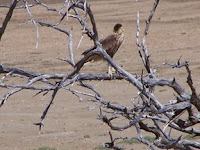
Inside the park you can see large Iguanas and lots of bird life. We saw this bird species several times, an Osprey. We have one that frequents the condos in front of our boat also. He perches high on the condo roof overlooking the sea.

The Yellow Shouldered Parrot is an endangered species and a rare sight. We saw this one on the way to the park. You can always find Flamingos in the park.


There are several Beaches and Dive sites in the Park. This is Playa Funchi. We didn't bring our gear so we didn't dive here, there probably wouldn't of been enough time to dive and see the park. They are very strict about closing on time - you have to be on your way out by 4:00 PM to close at 5:00 PM.


With the abolishment of slavery in 1863, the Spanish brought donkeys to the island to cart water, salt and other goods. Donkeys were used instead of horses because they are stubborn and always follow the same route without a guide. These guys run free in the park and three of them came up to our jeep to feed on some potato chips. They were very friendly.
This house is in the park. You have to cross a dirt road that goes right through the water to get to it. Here is an Iguana road sign to warn you that there may be iguanas in the roadway. In Bonaire they use cactus for fence.
They plant full grown cactus which start to root and make the fence. They have special tools to help with the planting.
Bye for now, Mike and Kim on Ka'imi


Exploring Bonaire

CLICK ON ANY PICTURE TO ENLARGE

Bonaire is approximately 112 square miles, 24 miles long and between 3 and 7 miles wide. It is 50 miles from the Venezuelan coast with 13,000 inhabitants. The highest point is Mount Brandaris (241m, 790 ft), which is in the north of the island. We explored the South and Southwest areas of Bonaire on Scooters along with Ken and Roberta, Second Wind and Byron and Denise, South of Reality. The southern part of the island is dominated by the saltpans, wetlands and mangroves.
Bonaire is part of the Netherlands Antilles with its sister islands, Curacao and Aruba, to the west. Other Antillean islands include Saint Maarten, Saba and Statia. Bonaire's two main industries are salt and tourism, especially diving and eco-tourism. The salt mountains supply the solar salt industries in the world and were the main reason for the early introduction of slaves. Slavery was a part of the culture from the 17th - 19th century, and abolished in 1863. On the Southern coast are the restored slave houses. These were used to house the slaves working on the saltpans. The doors of these houses are at crawling height and barely big enough to stand up in. They used to house up to four men, but they hardly seem big enough for one!! During the week the slaves worked on the pans and then were allowed to walk home for the weekend, a seven hour hike to the settlement of Rincon. The salt pans also house the Flamingos. The Flamingos get their pink color by eating the shrimps on the saltpans. These shots were taken in flat marshlands on the southwest side of Bonaire. Flamingos live all over the island, we even met a lady that had 4 of them in her yard that she had raised since birth.


Windsurfing is a big attraction in Bonaire, most windsurfing takes place on the large lagoon on the southwestern windward side of the island, Lac Bay. The bay has a barrier reef which is calm and shallow which makes it ideal for windsurfing. Lac is also home to three globally endangered species: the Green Turtle, the Queen Conch and the mangrove trees. Bonaire National Marine Park enforces their legal protections.

We got lost at one point, but this sign cleared it all up. We saw several lighthouses on the island, the one to the right was at the southern end and the one on the left was on the southwest side. The great fun was the lighthouse was open so we were able to climb to the top for an incredible view.
The roads were all dirt out there, but our 100 cc scooters handeled it very well.
Adios for now, we will have an update of our explorations to the northern part of the island next. Hope you are enjoying the updates and leave us some comments, we enjoying hearing from you!!!!
Til next time, Kim and Mike on Ka'imi..................................


Google

The Cruising Yacht SiteRing

Previous | List | Random | Join | Next

SiteRing by Bravenet.com